Nowadays mariners are well aware of the importance of anti-grounding function in ECDIS. It is well clear that any alarm emerged while route checking should be addressed seriously, especially if such alarm is relevant to the anti-grounding assessment. Here we wish to discuss one of such alarm occasions, which you may experience approaching the Chesapeake Bay in North America while heading to such ports as Baltimore or Norfolk.
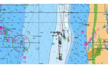
Approximately in 30 nm from Chesapeake Bay Entrance Whistle Buoy (Lat. 36-56.1N; Long. 075-57.4W) true bearing 120° (ENC US3DE01M), there are some areas with isolated soundings of 146 m and deeper surrounded with 182 m contour. But if your route is laid through those areas you may notice an anti-grounding alarm on the ECDIS. You will see that those areas are marked as Shallow Water even if your Shallow and Safety Contours are set well below 182 m. Why does it happen?
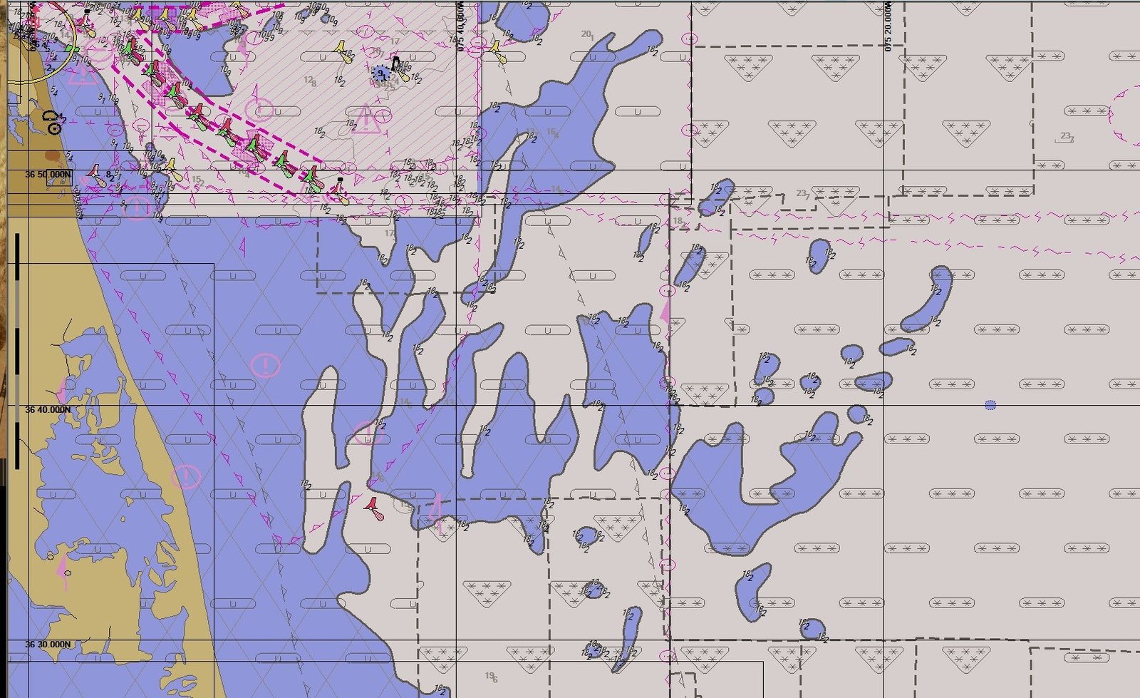
It happens because information on the chart is insufficient. Within the contour depth values may be anywhere from 0 to 182m, which means that something there may be reaching up to the water level!
Basically, because there is only one distinctive contour on the chart, any Safety Contour setting below 182 m (even 1 m) will highlight this contour (182) and fill the area within it with blue color. In our case Safety Countour = Safety Depth = 10 m. Also, note that ENC compilation scale is 1:350 000 and ZOC category is "C" (part of the display to the right on the picture below).
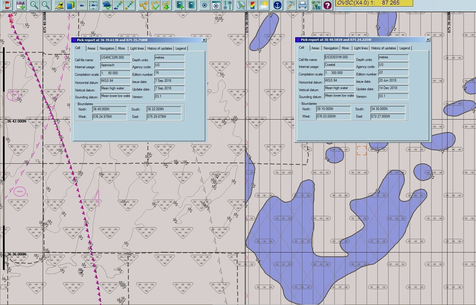
Because, if you have a look on the ENC US4NC32M (left part of the display) with compilation scale 1:80 000 and ZOC A1 Safety Contour is not highlighted at all.
This means that in this area there is no depth less than 10 m (at least on the larger scale chart) as it shown on the screenshot below.

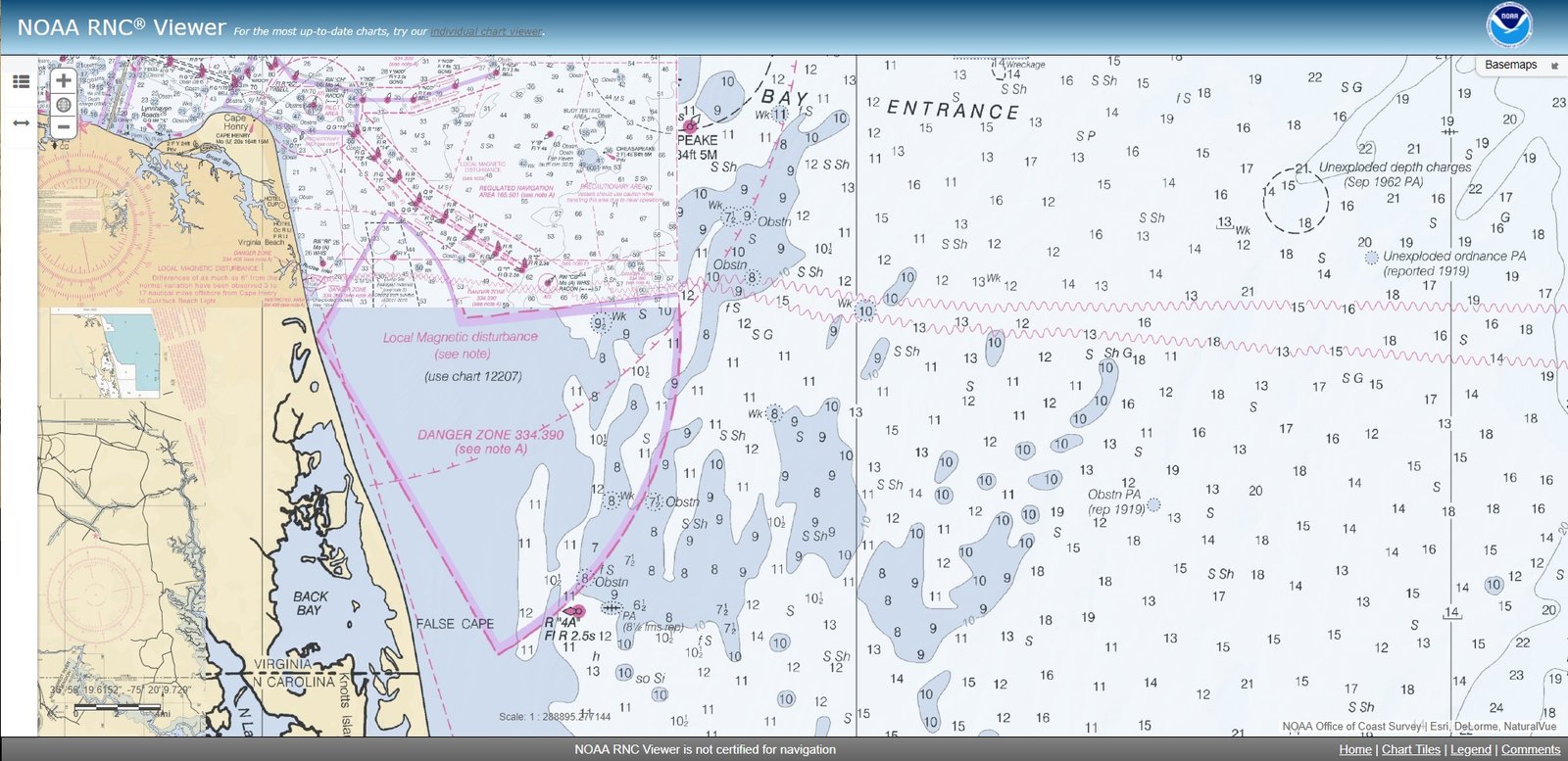
Also, the raster chart for this area gives the same information:
The appropriate hydrographic office will be informed via contracted Chart Supplier about those findings. Meanwhile, it is recommended to perform Passage Planning in this area with particular attention, carefully checking chart information with relevant ECDIS tool.


Comments