
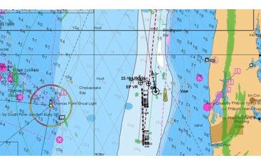
Can navigational charts be trusted? Any of them: paper, raster, vector, ENC’s? Nope! – they all have to be doubted, you can only trust your own eyes.
When we talk about ship position accuracy we are mainly referring to navigational equipment errors. This includes GPS (global positioning system), which can provide a continuous fix of position within the accuracy of 10 meters. However, to date, there is still a number of problems associated with the accuracy of displaying cartographic information, both on paper, and on electronic charts.
(1) The first, most obvious error is the accuracy of the transfer of position lines and fixes to the paper charts. According to the UKHO (United Kingdom Hydrographical Organization), the position on the chart can be plotted with a maximum accuracy of 0.3 mm, which, on a scale from the scale, is:
3 m at a scale of 1:10 000
15 m at a scale of 1:50 000
45 m at a scale of 1: 150,000
For electronic charts, this error is commensurate with the pixel size and is 0.2 mm.
(2) Another significant problem, not solved to date, is the seabed survey coverage. Far not all of the seagoing areas of the world are adequately surveyed. However, even surveyed areas often cannot be trusted. This is primarily associated with bathymetric research techniques used at the time of the survey. The accuracy of bathymetrical information in a particular area depends on scale, time of survey and the sounding method.
For example, when examining the bottom with a single-beam echo sounder or a mechanical sweep, the ship does not cover the area of a certain area entirely, but only passes through the specified lines. The depth between the lines may be obtained by interpolation. In fact, there may be a region with a smaller depth between the lines.
In addition, if a survey was carried out in the 80s when there were no satellite navigation systems, the accuracy of positioning certain sounding commensurate with the accuracy of determining the position of the vessel.
Without delving into the technology itself, it can be stated that the earlier a survey was conducted, the less accurate is soundings data on a chart. Often, on the same chart, the data of several bathymetric surveys is compiled.
Information on the bathymetry sources can be found on the chart itself, where it is usually indicated by whom and when the survey was conducted. If there are several such studies, a diagram (source data diagram) on which the boundaries of the regions and the dates of the studies are indicated are shown on the map.

There are also areas with a variable seabed structure. For example, river deltas, where silt is poured into certain areas, or in areas of abundant coral growth. In such places, the depths may also differ significantly from those indicated on the map.
In some offshore areas with no intensive navigation, seabed survey accuracy may not be high enough. This is specifically hazardous in areas with numerous coral formations, where sudden leaps of depths are possible. For instance, passing 100 m isobaths in the area of New Guinea, depth may suddenly change from 100 m to 40 m then to 10 m and back to 100 m, although there is no information on the chart (I experienced that myself once). And if you have a draft of more than 10 m - you might be already aground.
In the South China Sea, there is a whole region (map BA 3483, Palawan Passage), forming a quadrangle of about 300 x 300 miles, considered dangerous for navigation because unexplored shoals and coral reefs can be anywhere within 200 m of the isobath.
(3) Another important detail in assessing the safety of navigation is the consideration of the depth criterion for wrecks.
On the British Admiralty charts, you can find symbols for dangerous  and non-dangerous wrecks
  . When planning a voyage, it is important to consider how dangerous a wreck, designated as "non-dangerous", can be for a ship.
According to the UKHO depth criteria, a wreck is considered to be dangerous, if the depth of water over it is
for maps first less than
published
before 1960 14.6 m (8 fathoms)
1960 - 1963 18.3 m (10 fathoms)
1963 - 1968 20.1 m (11 fathoms)
1968 and after 28.0 m (15 fathoms)
(4) However, the biggest errors in determining the navigational parameters and position of the vessel can arise when the GPS position is transferred to a chart, either paper or electronic.
The problem is that not all areas of the world ocean are charted using WGS-84 (World Geodetic System 84) horizontal datum. Many charts are compiled either on the basis of other known ellipsoids or from unknown sources (which are mainly the charts of Central and South America, Africa, Indonesia, Malaysia, the Philippines). Errors that arise from binding to different horizontal datums, according to UKHO data, can exceed 400 m.
Case study. A passage plan for the port of Benoa (Bali) approach was prepared on the paper chart of the latest edition (CH BA 946, referred to WGS-84). Once waypoints were transferred from the paper chart to ECS (Transas NaviSailor 3000, updated with the latest NTM), it turned out that the positions differ by 50-100 m in relation to the landmarks. As it turned out, this happened because ECDIS retrieved the older edition ENC from the database with an indefinite horizontal datum. However, it made obvious that datum transformation errors may be substantial.
On charts with known horizontal datum, corrections are made to the positions obtained by GPS. However, even in this case, the correction to the GPS position can be unevenly distributed throughout the map and have only averaged value. On charts with an unknown horizontal datum, a corresponding warning is provided about the unreliability of positions determined by GPS in this area. Therefore, in areas not provided with charts compiled on the basis of WGS-84, it is strongly recommended to determine the ship's position relative to the landmarks. Dimensions of the vessel. Another source of error in determining the position of the ship in confined waters and, often, when anchoring, is the failure to locate GPS and radar antennas when fixing the position of the vessel. The dimensions of the vessel and the position of the antenna must be correctly indicated in the parameters of the electronic chart system. Also, this feature is available in some radar models.
If the distance from the hawse to the antenna is not taken into account, when calculating the position of the ship at anchor, the error in determining the radius of the safe anchorage will include this distance, which in the case of a ship with a stern superstructure may be as big as 50% of the indicated radius.
So be careful! Especially it regards African, SE Asian, and Southern American charts.
The best position monitoring tool in a narrow channel, regardless of all technical progress, is still your own vision. Everything else – just aids to navigation.
And remember: divider is not only an awesome tool for opening cans but also a nice piece of navigational equipment.


Comments